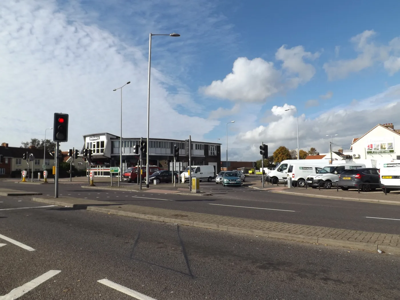

Cromer Road in Hellesdon had Broadland's highest nitrogen dioxide reading in 2025, at 26.4 against a legal limit of 40. Readings rose at 18 of 23 sites.
Cromer Road in Hellesdon had the highest nitrogen dioxide reading in Broadland last year. The council’s tube there averaged 26.4 micrograms per cubic metre across 2025.
That is well under the legal limit of 40, and no site in the district broke it. But readings went up at 18 of the 23 sites that were also measured in 2024.
The figures are in a draft Broadland Local Air Quality Strategy, which goes to the council’s Environmental Excellence Policy Development Panel at 6pm on Thursday 8 October. It is the first strategy of its kind for the district.
Where the readings are highest
The council measures nitrogen dioxide, mostly from traffic, with small diffusion tubes fixed to lampposts and buildings. Twenty-four tubes reported results for 2025. Hellesdon has four of the six highest.
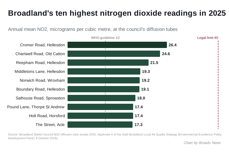
The Cromer Road tube is a kerbside site, one metre from the road. Chartwell Road in Old Catton, at 24.6, is the only other site above 22.
Every one of the 24 readings is above the World Health Organization’s guideline of 10. The strategy sets out both figures in its compliance table. The legal limit in England is the one councils are held to.
Better than 2021, worse than 2024
Sixteen tubes have been in place since 2021. Thirteen of them read lower in 2025 than in 2021. The biggest falls were at:
- Cromer Road, Hellesdon: 30.0 down to 26.4
- Chartwell Road, Old Catton: 28.4 down to 24.6
- Reepham Road, Hellesdon: 25.0 down to 21.5
- Wroxham Road, Sprowston: 20.4 down to 17.1
The three that were higher than in 2021 were Salhouse Road in Sprowston, The Street in Acle and Norwich Road by Wroxham library.
The short-term picture is less tidy. The strategy says air quality in Broadland “continues to improve”. Year on year, though, 18 of the 23 sites measured in both 2024 and 2025 went up. The report does not explain the rise. Only five went down: Yarmouth Road in Thorpe St Andrew, Wroxham Road in Sprowston, Middletons Lane in Hellesdon, Station Road in Reepham and Norwich Road in Coltishall.
Every site, 2021 to 2025
| Site | 2021 | 2024 | 2025 |
|---|---|---|---|
| Cromer Road, Hellesdon | 30.0 | 26.1 | 26.4 |
| Chartwell Road, Old Catton | 28.4 | 23.7 | 24.6 |
| Reepham Road, Hellesdon | 25.0 | 20.1 | 21.5 |
| Middletons Lane, Hellesdon (BN42) | 19.5 | 19.3 | |
| Norwich Road, Wroxham | 21.5 | 18.6 | 19.2 |
| Boundary Road, Hellesdon | 21.6 | 17.3 | 19.1 |
| Salhouse Road, Sprowston | 16.7 | 17.1 | 18.0 |
| Yarmouth Road at Pound Lane, Thorpe St Andrew | 19.0 | 16.9 | 17.4 |
| Holt Road, Horsford | 16.0 | 17.4 | |
| The Street, Acle | 16.9 | 16.7 | 17.3 |
| Wroxham Road, Sprowston | 20.4 | 19.2 | 17.1 |
| Station Road, Reepham | 17.0 | 16.8 | |
| Yarmouth Road, Thorpe St Andrew | 19.3 | 17.9 | 16.6 |
| Mile Cross Lane, Hellesdon | 18.8 | 15.8 | 16.5 |
| High Street, Coltishall | 15.2 | 16.4 | |
| Drayton High Road, Hellesdon | 19.0 | 14.3 | 16.1 |
| Red Lion Street, Aylsham | 14.4 | 16.0 | |
| Norwich Road, Wroxham library | 15.7 | 13.8 | 15.8 |
| Norwich Road, Coltishall | 16.3 | 15.8 | |
| Falcon Road West, Sprowston | 14.3 | ||
| Middletons Lane, Hellesdon (BN18) | 14.1 | 12.2 | 13.0 |
| High Street, Cawston | 14.5 | 11.8 | 12.8 |
| Plumstead Road East at Thunder Lane, Thorpe St Andrew | 10.7 | 12.6 | |
| Fifers Lane, Hellesdon | 13.8 | 11.9 | 12.4 |
All figures are annual means in micrograms per cubic metre. A blank means the tube was not in place that year. Falcon Road West is new for 2025.
What the strategy proposes
Broadland has no Air Quality Management Area, the formal step a council takes when a legal limit is broken. The government now expects councils in that position to write a strategy for keeping the air clean anyway.
The draft runs for 2026 to 2028. It says most fine particle pollution, known as PM2.5, blows in from outside the district, so the council will focus on cutting how much people are exposed to rather than on overall levels. Its five priority areas are:
- keep monitoring and investigate any site where readings get worse
- target PM2.5 monitoring at the most vulnerable areas
- cut smoke from domestic burning through advice on fuel, stoves and responsible use
- raise public awareness, including of air quality indoors
- build air quality into the council’s wider decisions, such as planning
Government and health agency data place the district’s highest PM2.5 areas in Thorpe St Andrew, Acle, Wroxham, Aylsham, Hellesdon and Sprowston, according to the draft.
The report is clear that the strategy commits no new money. Anything bigger, such as more monitors or a campaign on wood burners, would need a separate decision and its own budget bid.
Councillors are being asked one specific question on Thursday. How hard should the council push on domestic burning, farm emissions and indoor air, given it has little direct power over any of them?
What it means for you
- You will get a say. After the panel, the draft goes to Broadland’s Cabinet later in October. If Cabinet approves it, a six-week public consultation is planned to start in late October. We will link to it when it opens.
- Wood burner owners: the strategy leans on advice, not enforcement. The legal rules already in force are enforced by Norfolk County Council’s Trading Standards: wood sold in volumes up to two cubic metres must have a moisture content of 20% or less, the standard behind the “Ready to Burn” label.
- If you live on one of the busier roads above, the readings are annual averages from a single tube on that road, not a measure of the air inside your home.
- The panel meeting is public. The agenda and papers are on the council’s meetings site.
Nearby planning changes that can affect traffic are tracked on our Broadland planning news page.
Have your say